Rivelare il territorio. Cristiane Muniz (Una Arquitetos)

The rapid growth of the City of São Paulo, which has grown from 240,000 to 20 million inhabitants over the last century, has caused not only social problems, but also environmental ones. Typical geographic characteristics like hills and rivers have been reduced, sometimes eliminated. The installation of infrastructure facilities has required an architectonic dimension of these urban works. The task of the architects is to reveal this territory through a restructuring of the infrastructure and the public spaces.
The urban plan in Mooca, Ipiranga
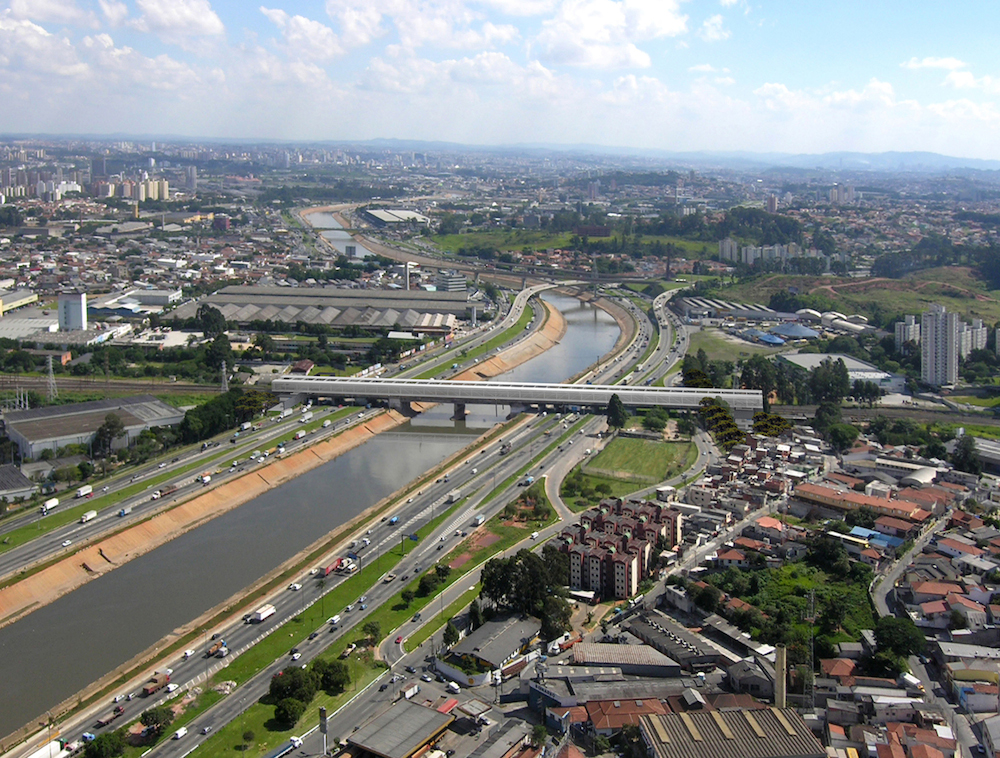
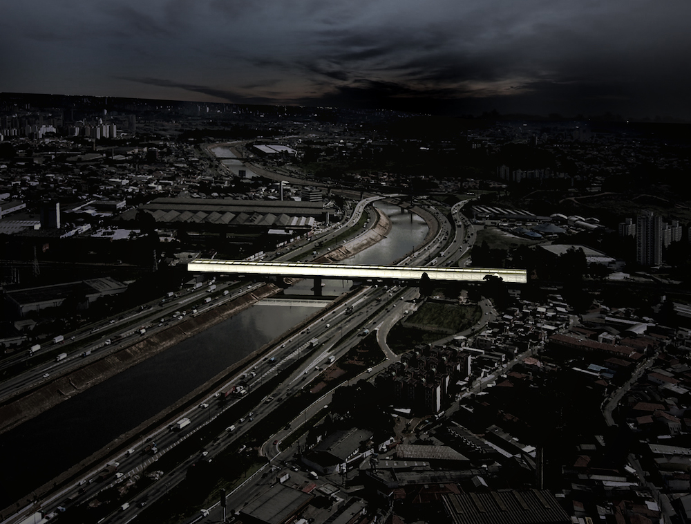
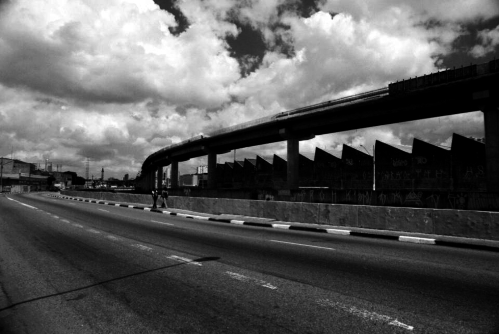
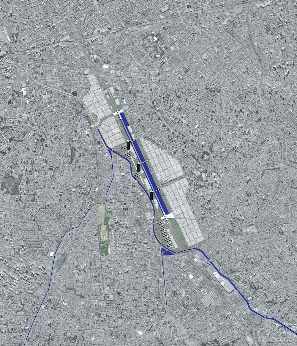
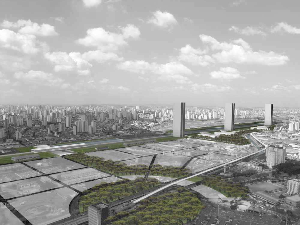
The closure of industries along the railway has made it possible to build a linear city park in Mooca. The work started in 2006 with an impact study on the urban fabric. The project exploits the storage areas, factories and open areas for several types of services. A lagoon has also been built next to the railway to improve drainage of the area and has avoided the frequent flooding that previously affected the area. This has allowed for the area’s more effective use. The restructuring of the public transportation system regulates the distances between the stations which give access to the railway on an upper level and the metro on a lower one (fig. 1).
A few factory buildings have had to be demolished to create connecting spaces between the main new infrastructure projects and integrate the public areas, but others have been kept to preserve the identity of the area. Inside the park, in the Ipiranga area where there are three favelas in which 10,000 people live, there are plans to build both social housing to replace the current makeshift dwellings and multifunctional buildings to relate the railway to the lagoon. This is a very important project that will transform these empty urban spaces in the centre of the city.
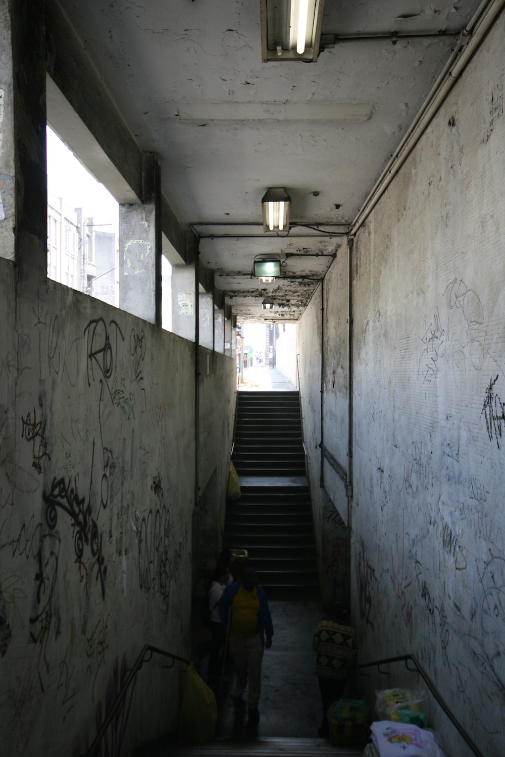
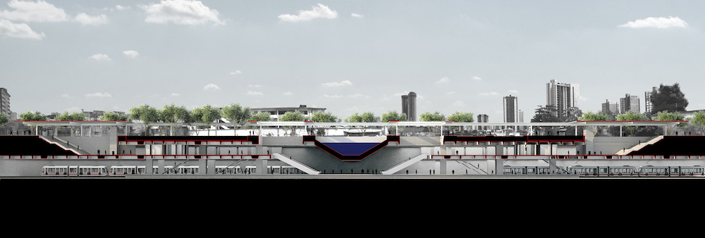
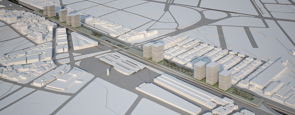
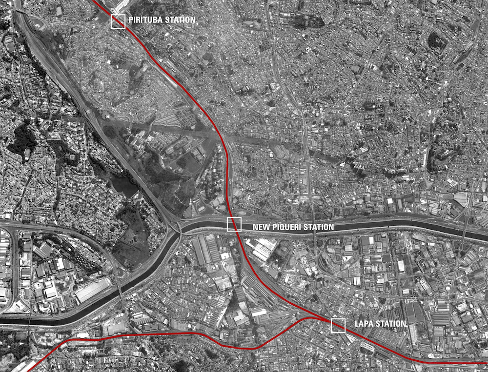
The new railway stations at Piqueri and da Lapa
As São Paulo suffers from serious traffic problems (there are 5 million cars on its streets every day with only the driver in them) and the railway, once only for goods, has become one of the ways to move from the suburbs, the rail system is being used to overcome some transportation difficulties. The challenge facing the engineers and the government is to raise the metro lines from 80 kilometres to 400 with investments that allow for its future enhancement.
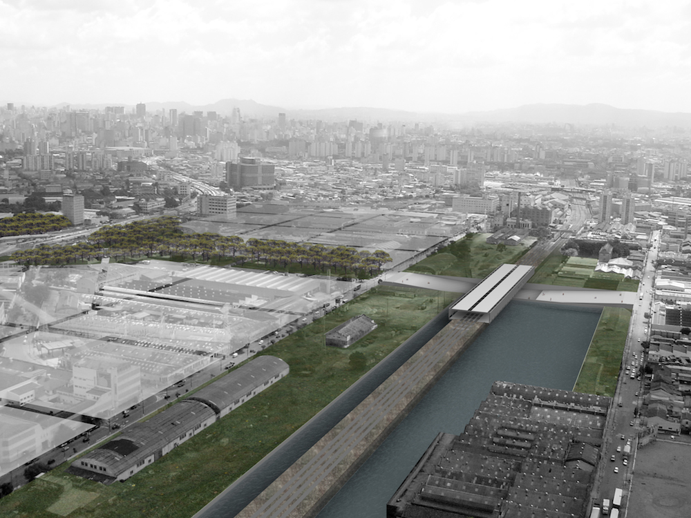
Exploiting the nearness of roads leading into the city there are proposals to transfer the station of Piqueri, where a large commercial centre is being built, over the river, to serve both the northern area and part of the southern together with the da Lapa Station which is currently, with 400,000 passengers/day, the third busiest station in the city. To do this the current railway bridge will be maintained and a platform and walkways for passengers will be built beside the tracks without which the tract would be very dangerous. The bridge will also be used as the support for the covering that, as this must span 80 metres, will be in metal.
The da Lapa project, in one of the oldest and most vital parts of the city, develops along the railway which splits into two lines with stations 800 metres apart. The project will stitch together the urban fabric with a strategy to be implemented in several phases: initially all the lines will be transferred to a single station and foundation walls will be built; later pilasters and platforms to support the trains will be erected so the rail service can be moved; then a second level, a mezzanine, will be built, making it possible to set up a temporary station; finally the station will be lowered, the connection recreated and a canal which runs through the area will pass through it and a covered plaza will be placed above it (fig. 2-3)
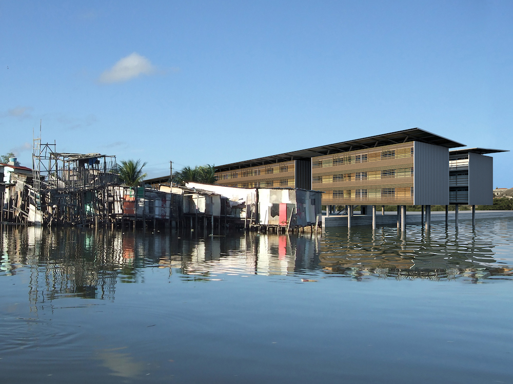
Housing in Caranguejo Tabaiares, Recife
The progressive government in Recife, the capital of Pernambuco in northeastern Brazil, is investing a lot in urban transformation. It is experimenting a new land occupation plan which calls for the placing of people in the city and not in the outskirts as usually happens, because, though it is cheaper to build in the outskirts, this would increase road traffic.
The city was founded at the junction of two rivers, concerning which at the beginning of the 20th century engineer Saturinino de Brito carried out a drainage project utilising rain water. The Municipality is now planning to build residential areas and public services along the river and a system of parks and open spaces connected with the river itself.
In Caranguejo Tabaiares, a small neighbourhood of a thousand or so houses, potentially beautiful, but very poor and with all its rivers polluted, we face the issue relative to these canals and the problems of the contact between water and trash.
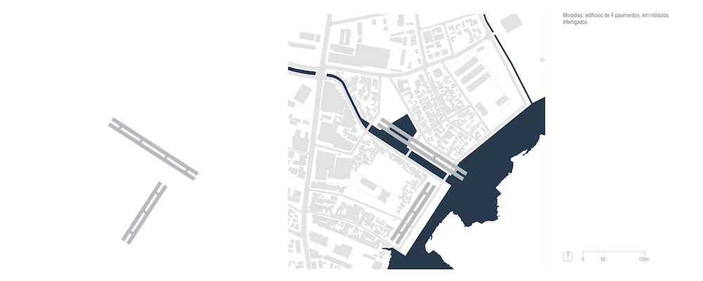
About 400 houses located in the riskiest areas near the canal where there was no room to circulate will be removed; freeing up the waterfront for the construction of an infrastructure system based on the one which already exists and social facilities such as a school, community centre, library, kindergarten and market.
For reasons of economy and speed the dwellings will be built in blocks of four floor modules. To alleviate the problem of the very high temperatures and thus protect from the sun, terraces will be built and filtering green areas will be placed between the buildings, to improve air circulation. Then, in view of the frequent rains, there will be systems for the reuse of rainwater. As today not even trucks with building material can get into the area, alternative access routes have had to be set up. The project was presented at the Triennial of Architecture in Lisbon in 2010 (fig. 4).
EWT/ EcoWebTown n.6
Magazine of Sustainable Design
(Quadrimestrale on line sul progetto di città sostenibile)
Edizione SCUT, Università Chieti-Pescara
Registrazione al tribunale di Pescara n. 9/2011 del 07/04/2011