BRASILE. Dall'architettura sostenibile, una nuova dignità urbana a cura di Carlo Pozzi con Claudia Di Girolamo
torna suNotes on the sidelines of a regenerative proposal for the informal city of Florianópolis,
Luigi Coccia
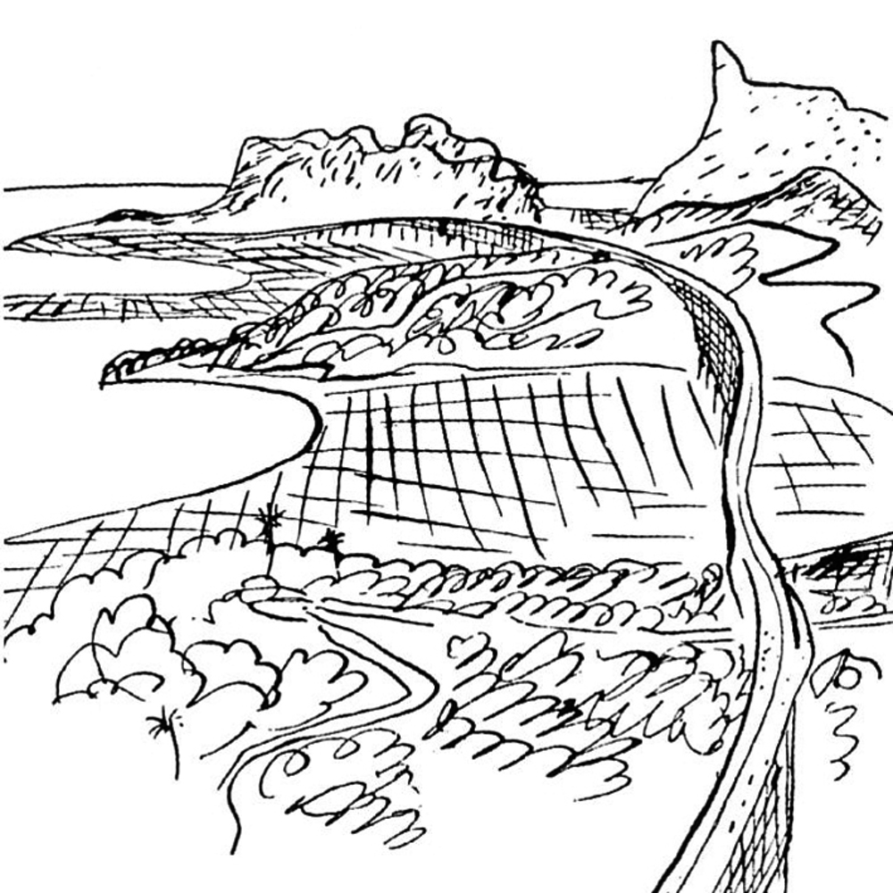
It is a "sublime landscape" what Le Corbusier detects flying over the geographically shaped up Brazilian territory in 1929: "we see it, we’ve conquered it, we’ve built it."
The view from above records the forms of a tropical nature in which reliefs, inlets and islands form the background of human settlements. This view offers some insights into Le Corbusier’s development of his project proposals for Sao Paulo and Rio de Janeiro: solutions formally different that however express the same intention of operating a radical reorganization of the urban context.
The infrastructure design is at the foundation of the new project’s vision: a cardo-decumanus system overlaps the city of Sao Paulo projecting it into the extended dimension of the territory; a long serpentine line creeps in between the bays of Rio avoiding a modification of the layout of the existing city.
"The lighter the touch, the stronger the control," writes Le Corbusier, explicitly referring to the way in which these inhabited mega-structures should make contact with the ground.
Literally landing on the ground, the new architectural forms so conceived, enact a real space conquest, openly enunciated by Le Corbusier in his writings and graphically translated in bird's eye view representations – the manifestation of his preferred aerial perception of the territory .
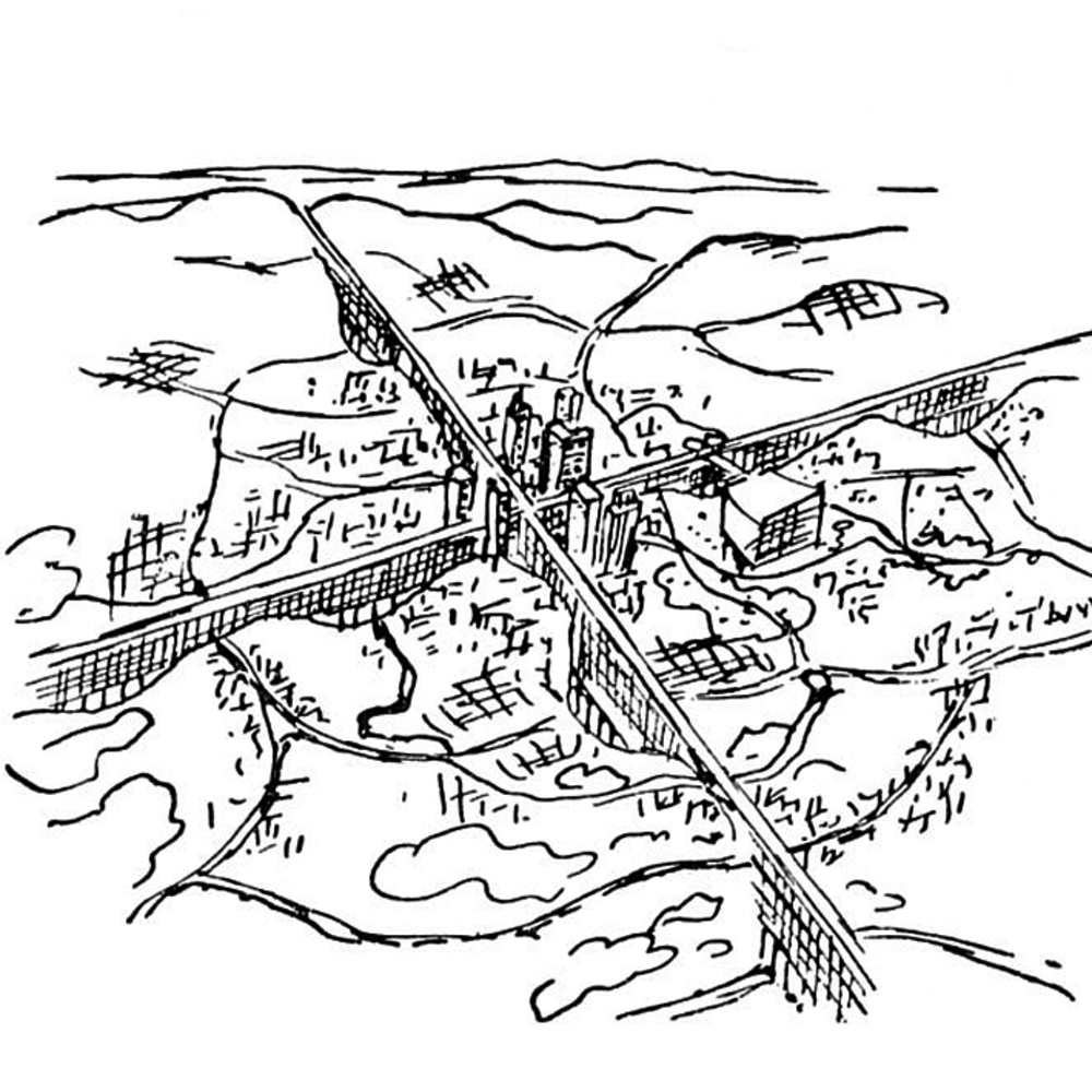
Nowadays satellite images offer a global aerial view of the world, and it was precisely a satellite photo that activated the first reflections on Florianópolis, capital of the state of Santa Catarina in Brazil.
The large print of a zenith photo of the Brazilian city stood on the bare wall of a classroom of the Faculty of Architecture of Pescara, the space in which, in November of 2012, a stimulating project workshop entitled "Favelas with a View" took place, with the primary aim of proposing a regeneration of the informal city.
The focus was on the insular side of this metropolitan conurbation, and more specifically on the informal settlements that occupy the western side of Mont Serrat and the eastern side of Penitenciaria, reliefs belonging to the Morro da Cruz, a granitic massif disposed in the north-south direction and covered with lush vegetation.
The proposed project conceives this large green area as a valuable spatial reserve for the island of Floripa, a privileged place, which reaches a height of almost 300 meters from which it is possible to view the city in relation to the territory and the sea.
Whilst giving to the geographical footprint of the site, and specifically to the Morro da Cruz, a primary role in the connotation of the urban development, the project’s strategy rejects a macro-design approach and seeks to explore the micro-scale of living in the favela. Overturning a typically modernist conception that has attempted several times to promote regenerating actions on overseas territories applying models radically opposed to local traditions, the project’s reflection begins with a survey of the current situation and suggests some actions related to ongoing dwelling practices.
The survey therefore attempts to decipher the articulated morphology of the favelas of Florianópolis, expression of uncontrolled building practices that invade the inner urban areas, on the fringes of the main road network.
The zenith view of these areas was not sufficient to understand the dynamics of the existing phenomena, so a close exploration was necessary, underpinned by photographs grasping the specific nature of the open space, usually interstitial and residual.
With the intention to understand the constitutive structure of the informal settlements and, at the same time, to detect the critical aspects of the degraded urban network and the potentialities associated with the local resources, the investigative work translated itself into the development of some descriptive maps: maps of solids and voids, of the dwelling density, of the connective network, but also maps of natural resources and of risks, specifically the hydrogeological one, which provided opportunities for discussions in the working group.
Making use of the knowledge acquired, the project workshop has conceived the blank space as a central theme around which a regenerative proposal for the informal city of Florianópolis has been produced. “Liberar espaço” has become the motto of an operation that seeks the requalification of the favela through actions aimed at the realisation of empty spaces within the solidity of the buildings’ network.
“To free space” is an expression that acquires a value that is both political and social, before being formal, and which presupposes a sharing of intentions and thus the inhabitants’ willingness to modify the existing state in order to improve the quality of life in the favela. Freeing space requires micro-demolition operations strategically combined with relocation operations, to be enacted presumably in the immediate surroundings of what is being removed.
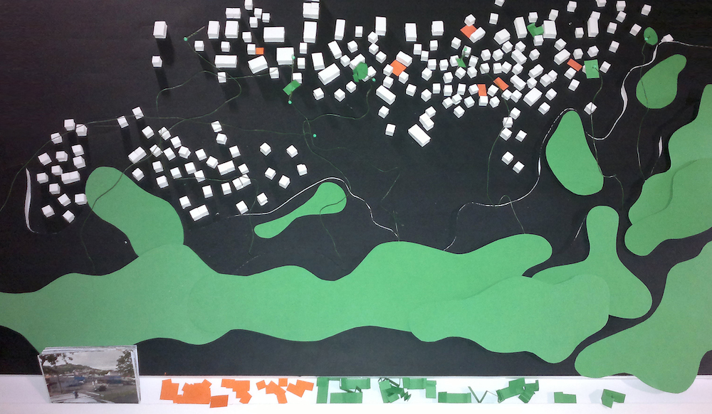
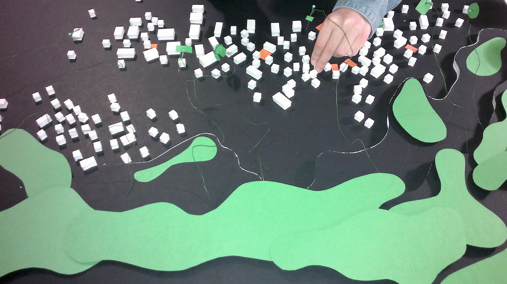
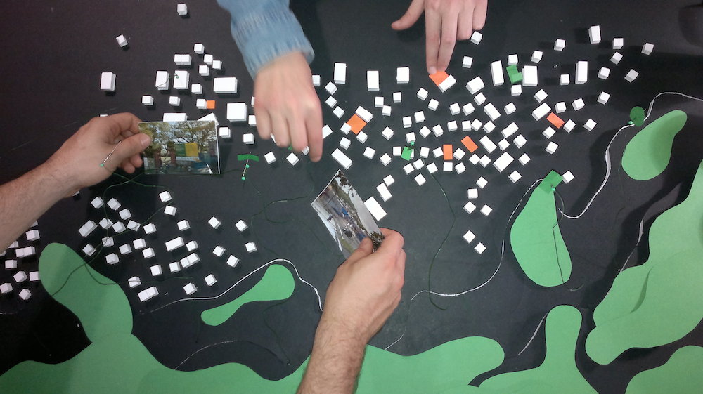
The instrument used to express the idea of the project was an interactive model designed to implement a transformative process that requires the participation of the local inhabitants. Rather than offering a formal solution to the problem, it was decided to lay out a strategy, anticipating some possible solutions.
The model thus becomes a dialectic instrument involving the local inhabitants in the choice of the sites in which to implement the transformation.
The shared micro-demolition kick-starts a regenerative process underpinned by a chart of probable formal configurations conveyed by architectural examples of reference – types of spaces that require, at a later stage, an inevitable topological adjustment.
The interactive model therefore describes the state of the place and at the same time defines the platform on which to operate a rewriting of the favela through urban micro-injections. It provides the operators with materials to use in the reconfiguration of the public space within the buildings’ fabric: ideogrammatic blocks of open space and postcards of possible reference examples are, mainly, devices needed to trigger a debate on the regeneration of the informal city.
The model finally recalls the greatest resource of the place – that reserve space in geographical scale on whose slopes lay the favelas of the insular side of Florianópolis – and it proposes a device that tends to connect, through interstitial pathways, the newly formed micro-spaces with the existing public macro-space.
EWT/ EcoWebTown n.6
Magazine of Sustainable Design
(Quadrimestrale on line sul progetto di città sostenibile)
Edizione SCUT, Università Chieti-Pescara
Registrazione al tribunale di Pescara n. 9/2011 del 07/04/2011